Friday 28 December 2018

Flash flood prepping: A quick refresher

Flash floods are a reality for many homeowners across the country. In fact, because of the recent frequency of extreme weather, more places have been experiencing flash floods than in the past decades.

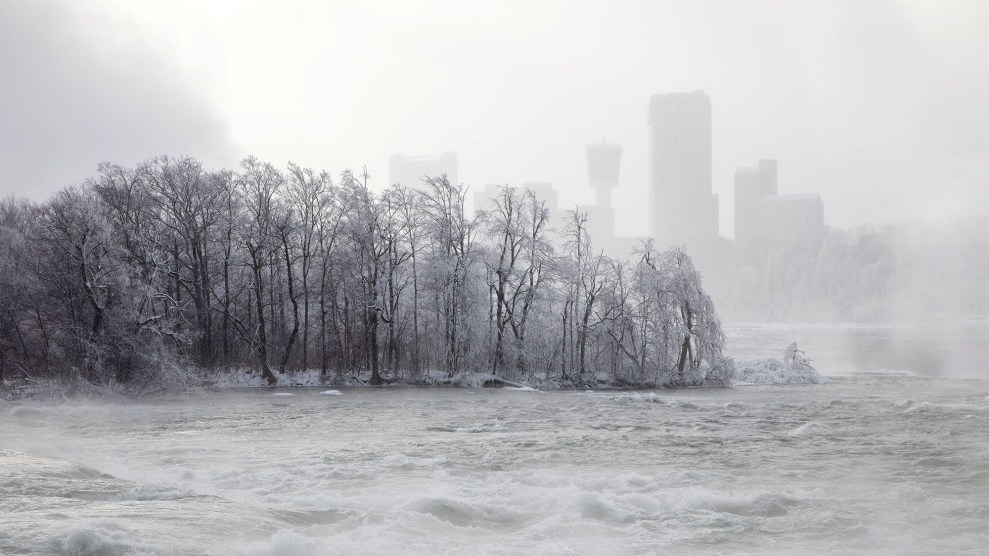
Because of this, we’ve thought it prudent to once again give a quick refresher on how to prepare for flash flood and not be caught unawares.

Image source: CNN.com
The emergency kit
Every household should have an emergency kit. In it should be first-aid kits, toiletries, medicines, beddings, non-perishable food, water, clothes, flashlights, matches, transistor radios, batteries, whistles, pocket money, and ID cards. Experienced preppers recommend having one emergency kit per adult at home.
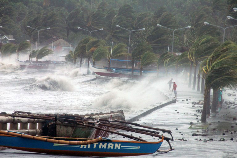
Weather reports
Image source: eco-business.com
To be up to date, people should always stay tuned to the radio or TV or any online news outlet, especially amidst sudden heavy rainfall. If people live near a dam, there should be regular updates on the status of the structure during severe weather conditions. If news reporters tell people to evacuate, homeowners should not give the injunction a second thought.

Have an escape plan
People should always have an escape plan in view of different kinds of disaster. They should know where to go when disaster strikes. For areas that experience flooding, residents should have a clear idea of the location of and the fastest, safest route towards the higher ground.

Jim Byrne is a weatherman serving a consulting meteorologist for the Weather Channel program “So you think you’d survive.” He is an alumnus of San Jose State University and is an appointed member of the Community Advisory Council for the Santa Barbara County Air Pollution Control District. Read more about weather phenomena on this page.

Wednesday 5 September 2018

How Space Weather Affects Earth And Its Climate

It doesn’t normally take up space on primetime news, but space weather affects life on Earth in more ways than one. What we call space weather refers to events on the sun that can disrupt Earth’s communications, overload power grids, become potentially hazardous to astronauts, and affect weather patterns, according to NASA.

Image source: SpaceNews.com

Accelerated particles from the sun as well as other galactic sources continue to bombard Earth. Space weather storms can disrupt and damage modern and technologically complex systems, such as communications, transportation, and electrical power systems. Space weather can also change Earth’s weather and climate, although there isn’t comprehensive knowledge on this influence yet.

The planet’s magnetic field serves as its radiation shield. The magnetosphere keeps most of space weather effects where they should be -- safely out in space. Some radiation, however, are able to reach orbiting satellites and astronauts, as well as people inside aircraft and sometimes even those on the ground. Energetic particles, too, can destroy satellites and reduce their intended lifespans. 

NASA’s Advanced Composition Explorer (ACE) is a spacecraft carrying nine instruments, each designed for observing various aspects of the solar and galactic environment. It detects information on the energy, speed, and magnetic field of every solar disturbance heading toward Earth, transmitting radio warnings to people up to an hour before their arrival. Scientists, meanwhile, continue to probe space weather’s further impact on Earth and its global climate.

Image source: Blogs.Nature.com

Jim Byrne is a weatherman serving a consulting meteorologist for the Weather Channel program “So you think you’d survive.” He is an alumnus of San Jose State University and is an appointed member of the Community Advisory Council for the Santa Barbara County Air Pollution Control District. Read more on this page.

Thursday 9 August 2018

What Causes a Heat Wave And Is It Related To Climate Change?

A heat wave refers to both a prolonged period of high temperature and excessive humidity.  Heat Index Values are used to determine if the heat in a particular period is already excessive, which is essentially the measurement of apparent temperature or the effect of temperature on the human body when humidity is factored in. 

A heat wave happens when high atmospheric pressure system moves into a particular area, pulling air from the upper levels of the atmosphere toward the ground.  This air becomes compressed as it nears land and creates high levels of humidity.  Because of the pressure’s concentration, other weather systems are unable to replace it; rainclouds and cooling winds are pushed away.  A heat wave can thus last for days or even several weeks. 

Image source: brecorder.com
It’s important to note that while heat waves are yet to be completely linked to climate change, they are weather phenomena that over time could signify the warming of the planet.  This is especially true in recent years, with the increase in the frequency of heat waves throughout the world. 

There have been record highs in temperatures in recent years, evidenced in North America by increased occurrences of heat waves in Canada and the United States.  An interesting trivia to remember here is that these high-temperature events kill more Americans than other natural disasters like lightning, floods, tornadoes, or storms.  Children and adults over 65 years of age are especially susceptible to heat exhaustion and stroke. 

Image source: ajp.com.au

Weatherman Jim Byrne is an alumnus of the San Jose State University. He is formerly the chief meteorologist at KCOY CBS-12 and a weather reporter for NBC Bay Area. Know more about Jim’s work and advocacies here.

Friday 6 July 2018

What Is The Summer Solstice? Here Are Interesting Facts

It’s commonly known as midsummer, immortalized in many works of art and literature.  But the summer solstice actually takes place when one of the Earth’s poles keeps its maximum tilt toward the sun.  It occurs twice a year, one in the Northern Hemisphere and another in the Southern Hemisphere.  Here are interesting trivia about the summer solstice.

Astronomers can calculate an exact moment for the solstice, when the planet reaches the point in its orbit where the North Pole is angled closest to the mighty sun.  This year, that moment was at 6:07 a.m. Eastern time on June 21, and from Earth the sun appeared farthest north relative to the stars.


Image source: Collective-Evolution.com 

There are many world traditions built around the summer solstice.  In the Northern Hemisphere, it’s historically linked to awakening libidos.  Small wonder: it tends to kick off the beginning of the summer season accompanied by the harvest.  Naturally, the solstice will be linked to fertility in many places around the world.

The Scandinavian tradition of celebrating midsummer involves dancing around a maypole, a symbol viewed by some as phallic, as well as having huge feasts over herring and vodka.  In Greece, the pagan solstice has been co-opted by Christianity and called St. John’s Day, with ancient rites conducted in many villages.

Perhaps among the biggest solstice celebrations found anywhere is the one held at Stonehenge in England, where thousands converge every year to usher in the summer season.  Don’t forget the variety of bonfires, festivals, and Fête de la Musique celebrations in different parts of the globe.


Image source: Vox.com 

Jim Byrne currently works as the meteorological consultant for the Weather Channel program “So you think you’d survive.” He served as both the chief meteorologist for KCOY CBS-12 and as a freelance weekend meteorologist at NBC Bay Area. Read more about weather phenomena on this page.

Monday 11 June 2018

Bomb Cyclone winter storm explained

One of the more major meteorological occurrences reported in recent times is the bomb cyclone. People all over the East Coast were given ample warning regarding this development but what they experienced was something no one saw coming as entire cities froze. 

Image source: motherjones.com

Bomb cyclones refer to bombogenesis, a meteorological phenomenon that occurs when a storm’s minimum central pressure goes down by at least 24 millibars within 24 hours. Although bomb cyclones are supposed to be common in the fall and winter in the East Coast, they have greatly exceeded the intensification rate, almost doubling it. 

These hurricanes become stronger due to the lower air pressure. The rapid pressure drop draws air into the storm’s circulation. As the air spirals inward toward the center, rises, and exits to the top, the further the storm grows. Drops in air pressure also cause extreme wind conditions. 

Bomb cyclones bring heavy, wet snow and powerful winds. This combination can easily cause power outages. What makes bomb cyclones more worrisome is the fact that they can turn small clouds into massive storms within 24 hours. They are supposedly rare, but they are becoming a common occurrence these days due to global warming. 

Image source: pymnts.com

Weatherman Jim Byrne currently works as the meteorological consultant for the Weather Channel program "So you think you’d survive." He took up meteorology and journalism at San Jose State University and served as the chief meteorologist at KCOY CBS 12 and was a freelance weekend weather reporter for NBC Bay Area. For more insightful reads on the weather, visit this page.

Thursday 10 May 2018

Meteorology 101: Hurricanes, Typhoons, And Cyclones

Hurricanes, typhoons, and cyclones are all names given to the same type of extreme weather disturbances, intense lower-pressure systems that bring in powerful winds and rain and can potentially cause millions of dollars in damage once they hit land. But just what are their differences, and why give them different names?

Image source: earthsky.org


The term used by meteorologists for these developing weather disturbances is tropical cyclone. A tropical cyclone is born when moisture, warm tropical waters, and light winds combine with a weather disturbance. As the winds of the tropical cyclone get stronger, the closer it gets to either being a cyclone, hurricane, or typhoon. The target wind speed is 75 miles per hour. Once it hits that, the name changes, into one of the three.

And once the newly-formed hurricane, typhoon, or cyclone sustains its conditions over a given period, it brings on new and more devastating conditions such as torrential rains, and huge oceanic waves.

So, why the need for three different names? The names were coined to distinguish the location of the weather disturbance.

Hurricanes happen over the Atlantic and Northeast Pacific. Typhoons, on the other hand, form over the Northwest Pacific. Cyclones occur in the South Pacific and Indian Oceans.

Image source: rappler.com

Weatherman Jim Byrne serves as a consultant for the program “So You Think You’d Survive,” now under the Weather Channel. An alumnus of San Jose State University, he has also served as the chief meteorologist at KCOY CBS-12. More on Jim’s work here.

Wednesday 4 April 2018

What Exactly Is The La Niña Phenomenon?

La Niña is a climate pattern phenomenon that pertains to the cooling of surface ocean waters along the tropical west coast of South America. La Niña is the counterpart to El Niño wherein the equatorial region of the Pacific Ocean are marked by unusually warm ocean temperatures.

Image source: independent.co.uk


In some areas of the world, La Niña causes increased rainfall. Conversely, it generates extremely dry conditions in other regions. The conditions that cause La Niña recur every few years and can last for as long as two years. El Niño occurs every two to seven years, and La Niña sometimes follows El Niño. In the past, La Niña has been called the anti-El Niño and El Viejo, which means “old man” in Spanish.

The phenomenon happens when the easterly trade winds get stronger and blow more warm water west allowing cold water below the sea’s surface. It thus pushes toward the top near the South American coast, replacing the warm water. This means that the easterly trade winds are to be blamed for partly causing La Niña.

Image source: nydailynews.com


When La Niña occurs, the sea surface temperatures across the eastern and central Pacific Ocean tend to be lower than the typical 3 to 5 degrees Celsius. The main effects of La Niña include increased rainfall, catastrophic flooding, and drier than normal conditions.

Jim Byrne is a weatherman and former chief meteorologist for KCOY CBS-12. For more on his work and interests, visit this blog.

Monday 12 March 2018

NASA’s Role In Weather Forecasting

Image source: NASA.gov
Earth science is one area of focus of the National Aeronautics and Space Administration (NASA), which includes studying Earth’s weather system such as the dynamics of the atmosphere and its interaction with the land and oceans. Through its expertise and technology, weather, ranging from local to microphysical processes, can be predicted with a fair degree of success at about a maximum of two weeks prior.

NASA deems improved knowledge of weather processes and phenomena a crucial ingredient of understanding Earth further. In addition, there is an infrastructure in the United States for operational meteorology at NOAA, the FAA, the DoD, and other agencies requiring the introduction of new technologies and knowledge that only NASA can develop.

NASA contributes to national weather forecasting goals primarily through developing and using data from space-based sensors. For over two decades, satellite-based profiles of temperature and moisture have been regularly used in forecasting, while new NASA sensors promise to upgrade accuracy and spatial resolution.

Image source: ClimateCentral.org
Other technologies supporting weather, as developed by NASA’s earth science division, include the In-Space Validation of Earth Science Technologies (InVEST) program (RainCube and CIRis) and the EV class missions such as CYGNSS and TROPICS.

As a recent development, NASA’s Joint Polar Satellite System (JPSS) comprises four weather satellites that will provide advanced forecasting on not only hurricanes but also dangerous weather events that threaten communities across the country.

Weatherman Jim Byrne is a consulting meteorologist at the Weather Channel program “So you think you’d survive.” An alumnus of San Jose State University, he had also been the chief meteorologist for KCOY CBS-12 and a freelance weekend meteorologist at NBC Bay Area. Read more on this page.


Saturday 10 February 2018

Can You Predict The Weather By Yourself?

Image source: tematicaresearch.com
Some people might wonder if they can predict the weather without having to rely on forecasts. If you are one of those who do, the simple answer is yes. Here are some ways to do it:

Observe the direction of the wind: How the wind blows can be indicative of approaching weather. If the wind moves in from the west to the east, that could be an indicator that the weather would be good, while wind going in the opposite direction suggests that bad weather is coming. Another thing to watch out for is the behavior of smoke from a fire. If it does not rise steadily and spirals back down, it means that there is low pressure and that it will rain soon.

Watch out for the “calm before the storm”: There is a reason that expression came to be. Looming bad weather means there is low pressure, and this pushes out normal wind patterns, leading to lack of wind on the ground and calm or still water. The brightness of the moon may also be an indicator, as low pressure clears out dust that would have covered the moon a little bit.

Image source: almanac.com
Check out animal behaviors: Animals are capable of determining if bad weather is on the horizon. For example, ants build up their hills so that the sides would be steep to divert rainwater. Birds fly lower than usual or perch at branches nearer the ground because low-pressure air irritates them. Insects, particularly bees and butterflies, become less visible as they have already returned to their home for safety.

Jim Byrne is a weatherman who currently serves as a consulting meteorologist for the Weather Channel program and is the former chief meteorologist at KCOY CBS-12. To see more discussions about the weather, check out this Facebook page.